
Longmont ZIP Codes and Their Postal Reach
The current city-facing ZIP set to test in USPS lookup is 80501, 80502, 80503, and 80504. Exact carrier boundaries and delivery types are dynamic, so the postal result for a complete address controls. The table gives a practical research frame, not a legal boundary map. Use the city, county, parcel, and ZIP as separate fields.
| ZIP code | Practical Longmont use | Postal label | Notes |
|---|---|---|---|
| 80501 | Central, older, north, and east-side street addresses | LONGMONT CO 80501 | Verify each street address |
| 80502 | PO Box and processing designation associated with 80501 | Longmont routing linked to 80501 | Do not infer a street parcel |
| 80503 | West and southwest Longmont plus county-side postal addresses | LONGMONT CO 80503 | May cross Boulder County context |
| 80504 | East and southeast Longmont and nearby postal territory | LONGMONT CO 80504 | Routing label does not set city limits |
| 80540 | Lyons, not a regular Longmont city ZIP | Routing changed within Longmont scheme | Use only for an actual Lyons address |
| 80542 | Legacy Longmont ZIP | Former Longmont routing | Deleted effective March 1, 2019 |
The 2021 USPS routing bulletin lists the current Longmont routing set. A ZIP directory search should copy the recognized city and state from the address result, then retain the original address string for county and parcel work.
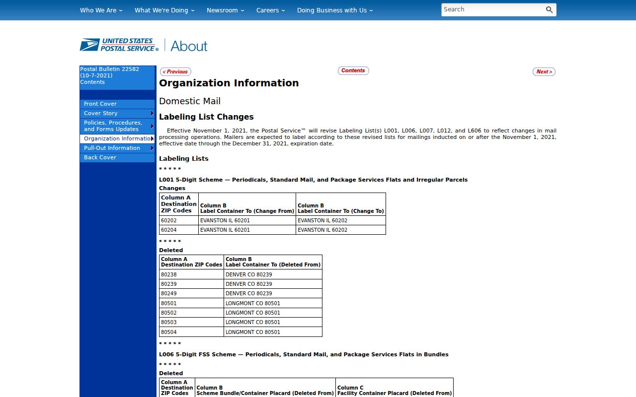
The USPS routing bulletin is a better source for postal labels than a city map. It should be paired with the parcel before any resident record search.
What the Longmont USPS Lookup Actually Asks
The official USPS ZIP lookup offers three modes. By Address checks a complete street line. By City and State returns recognized ZIPs for a place. Cities by ZIP shows the postal city names associated with a ZIP. These modes answer postal questions only. USPS warns that a ZIP match does not prove a person or company is at an address.
| By Address | Company optional; street required; apartment, city, state, and ZIP fields available. |
|---|---|
| By City and State | City and state required; returns recognized ZIPs for that postal place. |
| Cities by ZIP | ZIP required; returns recognized city names and routing labels. |
| Result controls | Find, revise, recommended city notices, and address-format notes. |
Use the returned city and ZIP as mailing evidence, not as the situs. If USPS suggests a recommended city name, preserve that note but still identify the county through the parcel. This is especially important around Longmont’s Boulder-Weld split and for addresses that use Longmont as a postal city outside the municipal line.
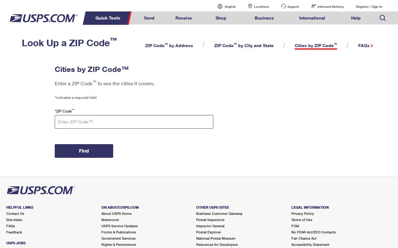
The USPS address form shows the inputs needed before a ZIP-keyed search can be trusted. A ZIP alone is too broad for a parcel match.
Finding Longmont Records by ZIP Code
Most Longmont public record portals do not expose a direct ZIP-wide parcel results mode in the inspected search forms. Boulder starts with address, owner, street, subdivision, account, parcel, and S-T-R. Weld uses account, owner, address portion, subdivision, parcel, S-T-R, and API. Go Vote uses residential ZIP as part of a personal name match. County voter reports may include a ZIP field, but they are request products rather than a street-browse page.
- Confirm the complete address and ZIP in USPS By Address. Save the recognized city, state, and any recommended-name notice.
- Search Boulder and Weld assessor portals by address and map, then choose the county from the parcel and legal description.
- Use county GIS to compare city limits, annexations, zoning, floodplain, district, and parcel geometry.
- For a lawful voter request, ask the relevant county or state custodian for only the fields needed and retain the report date.
- Once the ZIP narrows to a street, move to the Longmont by-street record chain.
A ZIP code directory can organize a research set after the address is validated. It cannot supply an absent public ZIP filter, create a household list, or replace the assessor’s parcel key.
80540 Routes Through Longmont History
80540 is a useful postal-routing trap. Research places it with Lyons rather than as a regular Longmont city ZIP, while a 2022 USPS bulletin records a route-label change from LONGMONT CO 80501 to LONGMONT CO 80503. The change concerns postal routing, not a transfer of land or a city annexation.
The 2022 USPS routing bulletin is the source for the 80540 label change.
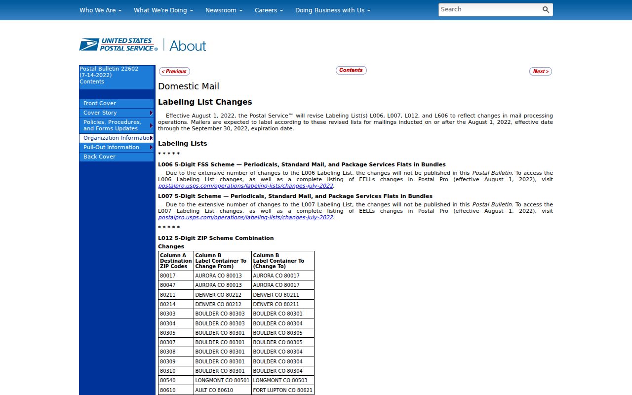
The 2022 USPS routing bulletin is the source for the 80540 label change. When a historical address carries 80540, retain the old label and test the actual street, county, and town.
This is why a Longmont residents search should never assign county jurisdiction from a ZIP. A directory or deed may use a post-office name. A current assessor parcel may be outside the city. A historical volume may group nearby communities under Longmont or Boulder. Postal history helps normalize the clue; it does not decide the record keeper.
80542 Was Deleted in 2019
80542 is a legacy Longmont ZIP. USPS deleted it effective March 1, 2019, after older routing lists had included it with Longmont 80501. A historical directory, deed, newspaper, or family paper can preserve 80542 even though a current address search should not treat it as active without verification.
The 2019 USPS deletion bulletin is the source for the effective date and legacy status.
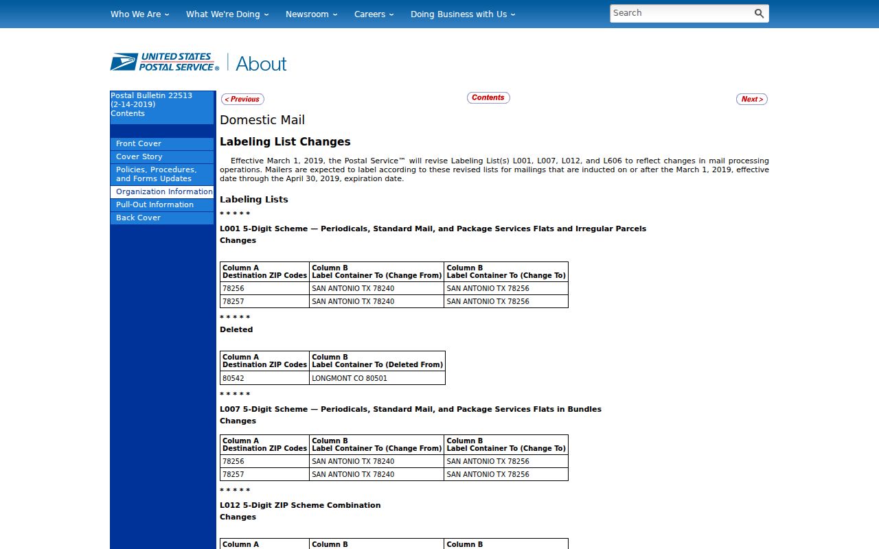
The 2019 USPS deletion bulletin gives the effective date. In a historical lookup, write the old ZIP as a source field and translate it to the street or parcel before comparing modern records.
Old city directories often have no ZIP at all. They may list a post office, rural route, telephone exchange, or nearby town instead. A failed modern ZIP search says nothing about whether a 1920 address existed. Read the directory’s front “City Record” and street guide, then use Sanborn maps, census districts, and legal descriptions to bridge time.
ZIP Boundaries and Longmont City Limits Diverge
Postal areas follow delivery routes. City limits follow municipal boundaries. County parcels follow legal descriptions and annexation records. Those three geographies can overlap without matching. A county-side parcel can use LONGMONT CO as its postal city. A city-limit parcel can have a nearby route label. 80503 and 80504 can therefore be useful search groups while still requiring a county and parcel check.
Boundary check. Use USPS for the mailing result, county GIS and assessor for the situs, and the city or county map for the municipal line. Never replace one with another.
- ZIP code
- A USPS delivery-routing identifier. It is not a legal parcel or city boundary.
- ZIP+4
- An added four-digit delivery segment that narrows a route within a ZIP.
- PO-box ZIP
- A ZIP used for post-office boxes or processing rather than a normal street parcel.
- Unique ZIP
- A postal code assigned to one institution or narrow delivery use rather than a broad neighborhood.
- Carrier route
- A delivery path inside the postal system. It can change without changing title or municipal jurisdiction.
Longmont’s ZIP code directory is most useful when it labels which geography produced a fact. “80503” is a postal key. “Boulder County parcel” is a records key. “Longmont city limit” is a municipal key.
Longmont ZIP Codes Are Not ZCTAs
The Census Bureau’s ZCTA is a statistical approximation built for data tabulation. It is not the same thing as a USPS delivery ZIP and should not be used as a legal boundary for Longmont parcels or residents. Population and density figures can be useful context, but they describe a statistical geography rather than the exact postal line.
The Census ZCTA guidance is the source for the distinction between statistical geography and USPS delivery areas.
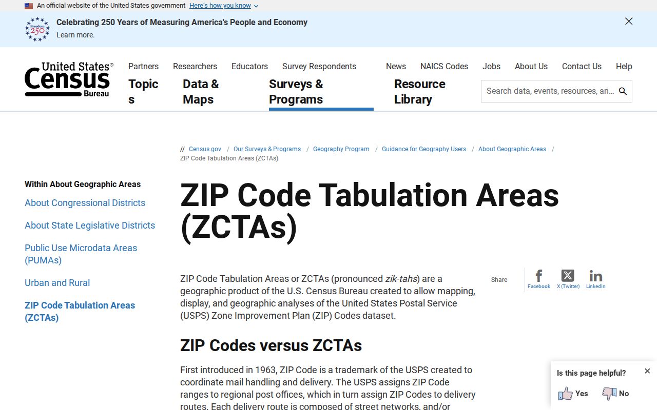
The Census ZCTA guidance explains the distinction. Use USPS to validate a mailing ZIP and county GIS to locate a parcel.
Longmont QuickFacts gives city totals such as 98,885 people in the 2020 Census, a 2024 estimate of 99,818, and 28.78 square miles of land. Those numbers describe the city as a whole. They do not count the names available in an assessor, voter, directory, or ZIP report, and they should not be used to infer household coverage.
The Longmont Census QuickFacts page is the source for the city-scale context.
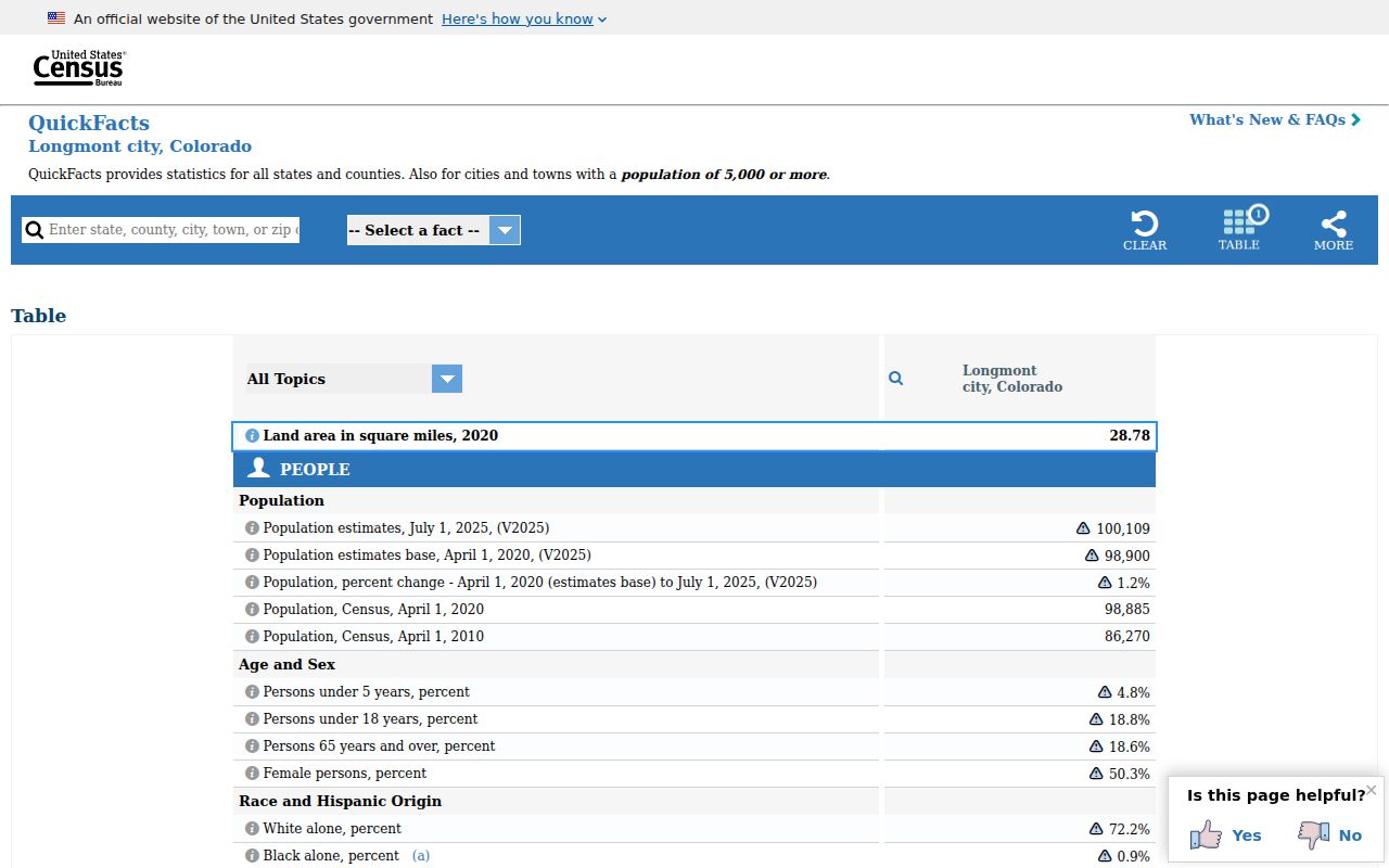
The Longmont Census QuickFacts page supplies city-scale geographic context, not a ZIP resident list.
Historical Longmont Addresses Rarely Use Modern ZIPs
A printed Longmont city directory may show a street, rural route, post office, telephone exchange, or nearby community without a ZIP. The 1912-13 directory included Longmont rural routes, Mead, Lyons, Hygiene, Niwot, and Highland Lake. Combined Longmont-Boulder volumes and regional phone books may use a place heading that does not line up with today’s city line.
Translate a historical address in stages: directory street and number, front street guide, Sanborn sheet, ward or addition, current parcel, then USPS result. Longmont’s original 1871 grid and the 1898-1919 voter wards are useful anchors. The 1909 ward adjustment and later annexation or subdivision records can explain a place mismatch. The ZIP is the last label in a current mailing check, not the first historical key.
When the parcel is known, the Longmont street directory handles the address-keyed chain. When the name is historical, the city directory collections handle the edition and entry context.
Use the Longmont ZIP Directory Stop Rule
A useful ZIP search stops when the postal question is answered. Do not stretch it into an unsupported claim about ownership, residence, or household composition. If a complete USPS result conflicts with the assessor city, preserve both and inspect the parcel. If a ZIP is historical, retain the old label and mark the current translation. If a voter report is requested, follow the county and confidentiality rules. If a portal offers no ZIP filter, say so and use the address or parcel mode it actually provides.
| Need | Use | What it cannot prove |
|---|---|---|
| Mailing ZIP | USPS By Address | Person or company at the address |
| Parcel county | Boulder or Weld assessor and GIS | Every household member |
| ZIP-wide statistics | Census geography, clearly labeled | Exact USPS delivery area |
| Historical normalization | Postal bulletins plus directory and map | Automatic current address equivalence |
The Longmont ZIP code directory is a disciplined first filter. Once it has done that task, move to the narrower official record and keep the postal, municipal, county, and household claims separate.