
Finding a Longmont Street Trail
A useful street directory begins with one complete address, not a broad name search. USPS can normalize the street suffix and ZIP, but the county comes from the parcel. Search Boulder and Weld when the edge is unclear. Then hold the account, parcel, legal description, and source date as the spine of the work. The owner shown by an assessor is not automatically the person who lives there, and a directory occupant is not automatically the titleholder.
The street-by-street chain moves from current parcel evidence to historical household evidence. It also leaves a clear stop point when a source is restricted or a name is ambiguous.
- Run the complete address through USPS, keeping the original postal line beside the normalized result.
- Test the address in both county assessor systems, then save the account, parcel, situs, mailing address, and legal description.
- Open the county GIS map, click neighboring parcels, and note city limits, floodplain, zoning, and district layers.
- Search the recorder for the owner as grantee, the legal description, and the relevant date or document type.
- Use Longmont Accela, voter sources, and historical criss-cross directories only for the question each can actually answer.
Longmont Street Directory Keys Start with Situs
Five address fields can look similar while pointing to different things. The situs is the physical place used by the assessor, GIS, and many permits. The mailing address is where an owner or taxpayer receives notices. A legal description names the subdivision, lot, block, or metes-and-bounds tract. The county account or parcel number ties records together. The USPS city and ZIP are postal routing labels, not proof of a municipal boundary or household.
- Situs address
- The physical property location. It may have more than one entry or change after a split, merge, annexation, or renumbering.
- Mailing address
- The notice address for an owner or taxpayer. It may be outside Longmont, Boulder County, or Weld County.
- Parcel
- A mapped tract with a county identifier and legal description. It is the strongest bridge across a street-label change.
- Plat
- A recorded map showing lots, blocks, streets, easements, or subdivision relationships.
- Criss-cross directory
- An address-first directory that turns a street and number into a past occupant, subscriber, or business clue.
Longmont’s county line makes these distinctions matter. A Longmont postal city can serve county-side land. A city parcel can carry a mailing line that is not the situs. Preserve both rather than forcing one “correct” address into every record.
Search Longmont Parcels by Street or Owner
The Boulder County Property Search is the primary Boulder-side starting point for a Longmont street directory. Its search bar accepts an address, owner name, street name, subdivision, account, parcel, or S-T-R. A map zoom and click can work when an old street spelling or partial address defeats a text search. The result should be read as a parcel card, then carried to the recorder and permit layers.
Open the property details and save the owner, mailing address, situs, legal description, neighborhood or market area, tax year, values, buildings, sales history, permits, zoning or septic clues, floodplain, and election district. Boulder’s print deeds report can bridge the parcel to the recorded-document index. Estimated tax displays are not the same as a tax bill, and confidential owners or addresses can be absent from downloads.
| Address | Physical situs search, exact or partial depending on the live portal. |
|---|---|
| Owner name | Assessed owner. Test initials, trusts, estates, and entity names when needed. |
| Street name | Useful for a street browse; narrow each result with a number or parcel. |
| Subdivision | Links a street segment to a plat, block, lot, or addition. |
| Account and parcel | County identifiers used by property, map, tax, permit, and deed bridges. |
| S-T-R | Section-township-range key for rural or county-side property. |
See the Boulder County GIS and property-search landing page when a street result needs the parcel card behind it.
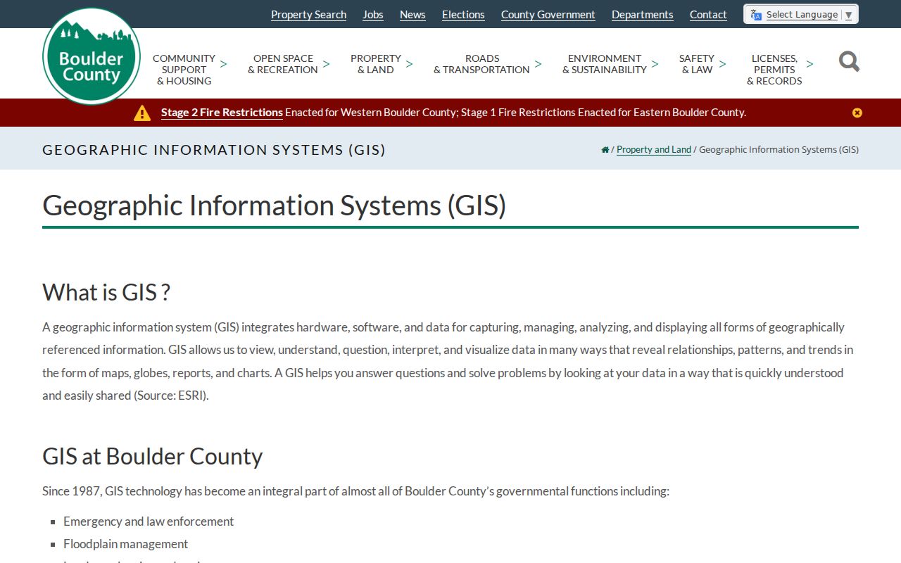
The Boulder property-search view makes the address-to-parcel handoff visible. Use the account and parcel from that result instead of copying a street name into every later search.
Weld Longmont Street Searches Use Accounts
On the Weld side, the property portal speaks a different field language. A street directory search can begin with an account number, owner name, address portion, subdivision, parcel number, section-township-range, or API number. A parcel search may accept the first six digits, and subdivision searches can use block and lot. The example account format begins with an R. Do not assume a Boulder account or legal-description format will work in the Weld system.
The Weld property report can show account, parcel, account type, tax year, buildings, actual value, local-government and school assessed value, owner name and address, land type and description, acres, and square feet. Values update on the county’s assessment cycle. The map adds address locating, parcel and owner labels, city limits, floodplain, contours, and historic imagery. A map label is a finding aid, not a boundary survey.
| Weld field | What it can do | Street-search note |
|---|---|---|
| Account number | Opens a property record | Retain the account for later tax and map work. |
| Address portion | Finds a situs string | Partial text can help when a full line fails. |
| Subdivision | Groups block and lot records | Useful for additions and street segments. |
| Parcel number | Matches the map and report | At least six digits may be accepted. |
| API or S-T-R | Supports specialized land keys | Keep spaces and punctuation as the portal expects. |
Use the Weld Property Data Search for the record fields, then keep the result tied to the Weld county jurisdiction rather than the Longmont postal label.
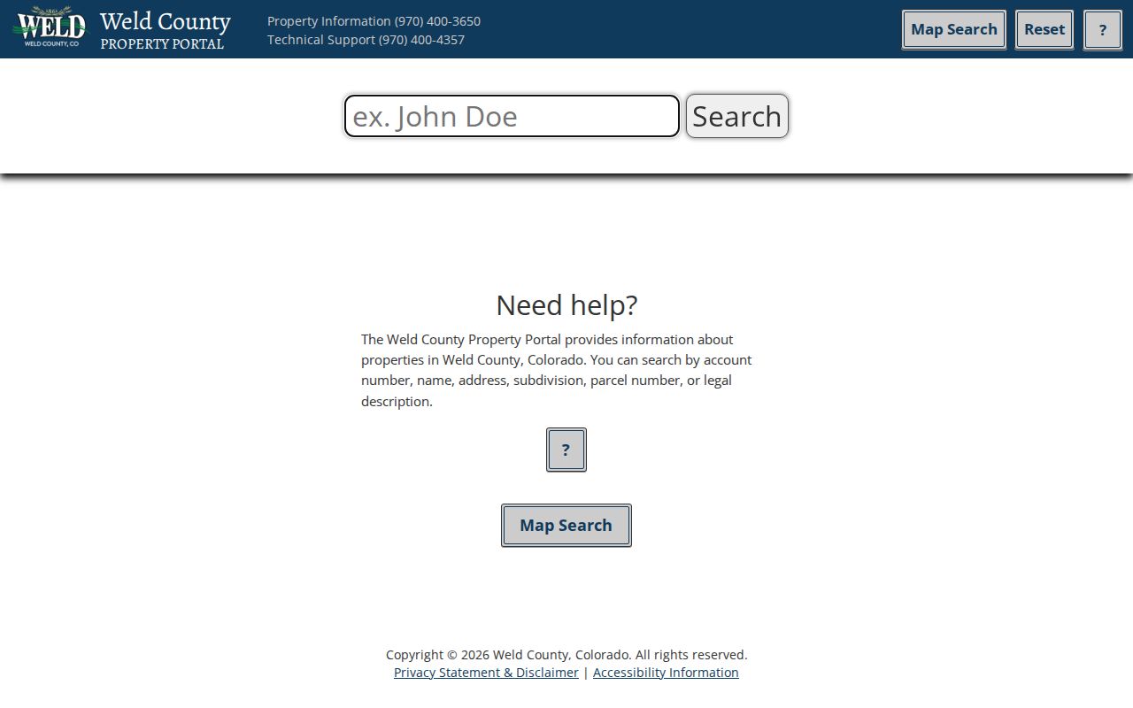
The Weld search screen shows why a street directory needs a field map. Account, parcel, subdivision, and API values each locate the same land from a different angle.
Longmont Records Searchable by Street
Address-keyed records form a chain, but each record has a distinct purpose. The table keeps owner, parcel, transfer, permit, and voter clues from being blended into an unsupported resident claim.
| Record set | Keeper | What it shows | Access |
|---|---|---|---|
| Assessor parcel card | Boulder or Weld Assessor | Owner, mailing and situs, legal description, values, buildings, sales | Free online card or report |
| GIS parcel map | County GIS | Adjacent parcels, city limits, zoning, floodplain, districts, imagery | Free public viewer |
| Recorded documents | County Clerk and Recorder | Grantor, grantee, deed, lien, plat, easement, recording date | Index, watermarked copy, office route |
| Permits and code cases | Longmont or county planning | Address, project, applicant, contractor, status, inspection activity | Portal; some documents require an account |
| Voter information | Colorado SOS or county clerk | Registered name, address, status, precinct, lawful history fields | Personal match or request |
| Reverse directories | Library, DPL, LOC, FamilySearch | Historical address-to-occupant or subscriber clues | Edition and image access vary |
The parcel number ties assessment to GIS and can help locate a deed or permit. The legal description checks whether the same land survived an address change. The street name helps with a human browse but can cross jurisdictions or historical additions. A street directory is therefore a route through records, not a claim that every person at every door is visible.
Longmont GIS Maps Each Parcel
Boulder County GIS links property search, parcel data, zoning, floodplain, open space, district, road, and public-health layers. Search or locate one parcel, click it, read the account and legal description, then pan along the street. Weld’s map adds an Address Locator, owner-name and parcel labels, acres, city limits, floodplain, contours, and historic imagery. The layers help explain why two adjacent addresses may be handled by different offices.
Use a map as a visual index. Confirm a boundary with a recorded plat or deed, not acreage or a screen polygon. For a block question, click each adjacent parcel and keep a separate row for parcel, situs, owner, mailing address, tax year, and deed date. A shared trust or public district may make several parcels look like one household, while a remote mailing address may make one owner look absent from the block.
Weld’s official planning instructions describe a reproducible 500-foot surrounding-owner workflow. Identify the parcel, choose Identify Point, select the blue Buffer tool, continue, and leave the distance at 500 feet. That output supports a land-use notice list. It is not a list of every person who lives within the circle.
The Boulder recorded-document search guidance provides the deed-index handoff after a parcel is identified.
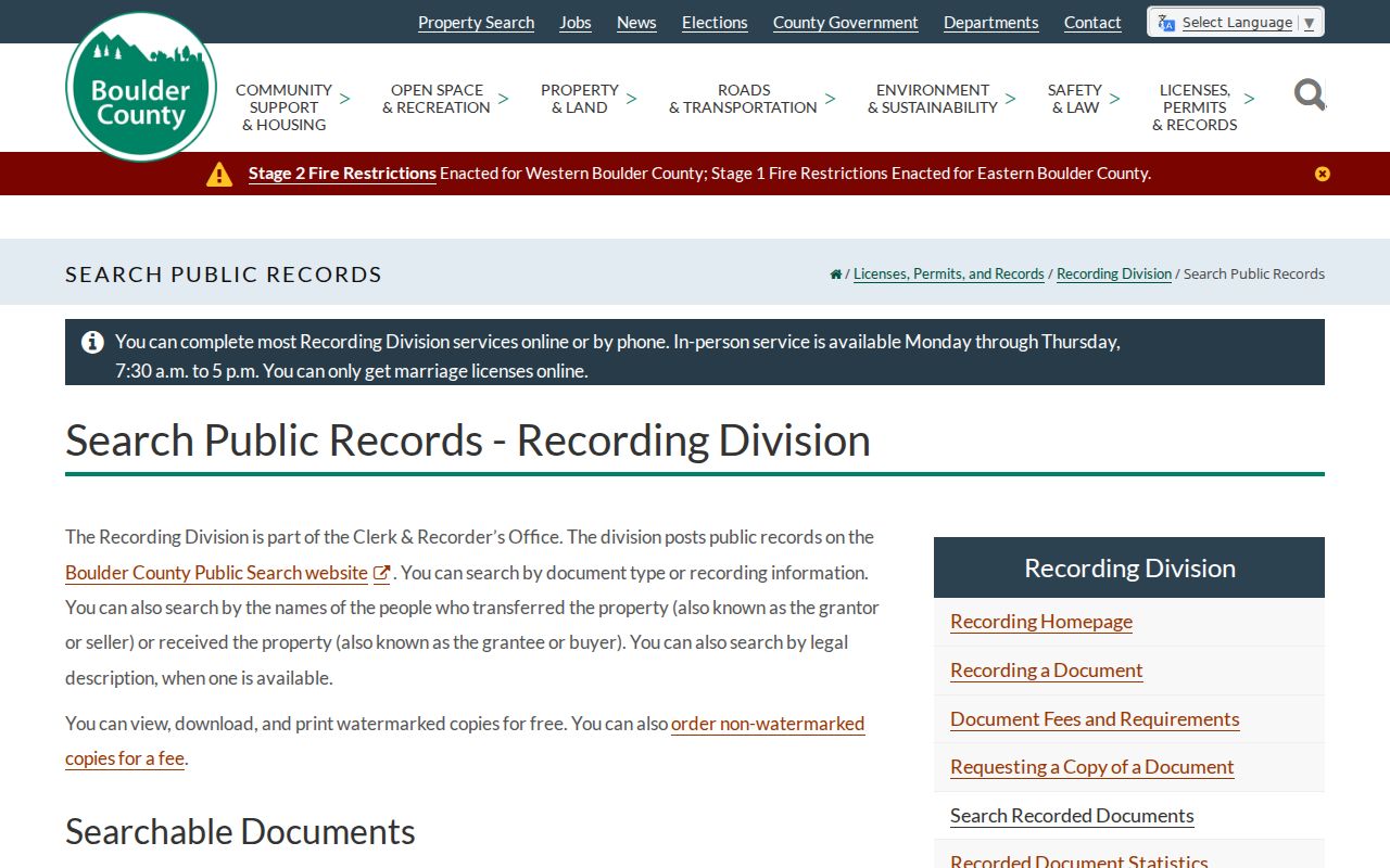
The Boulder recorded-document search screen illustrates how a parcel clue becomes a grantor, grantee, date, or document-type search.
Turn a Longmont Parcel into Deeds
The recorder’s index is a catalog of instruments. Boulder’s public search accepts a grantor or grantee, subdivision, document type, document number, legal-description term, and recorded-date range. It can search the index alone or index plus OCR full text. The Boulder portal shows deeds, liens, covenants, plats and maps, foreclosures, marriage or civil records, mining claims, UCC records, and assignments. Watermarked copies are free online; clean copies and certification use fee routes.
Weld EagleWeb states that its real-estate index and maps reach back to January 1, 1865, but warns that the index is like a library card catalog, not the instrument. Boulder’s online start year is not stated in the research. When a portal stops, use office books, mail, phone, email, drop box, or an in-person copy request. Preserve the reception or document number, recording date, exact parties, legal description, and image status.
For a current owner, search the person as grantee and find the acquisition deed. Read the grantor. Search that grantor as an earlier grantee. Repeat while the legal description stays the same. Branch for trusts, estates, companies, multiple owners, quitclaims, beneficiary deeds, releases, assignments, liens, plats, and probate conveyances. A lien is not ownership proof, and a reception date is not necessarily the signing date.
Open the Boulder recording search guidance for the field and copy rules. The address is only the starting clue; the legal description is the continuity test.
Longmont Permits and Historic Street Clues
Longmont Accela covers building inspections, certificates of occupancy, code enforcement, selected licenses, planning applications, and public works records. The official search guide supports record number, address, parcel number, global search, and department searches. Exact spelling matters. An address search can show records tied to the address, while login may expose more document features. Historic residential and non-residential permit reports are updated monthly through Building Inspection.
Use permits to build a construction and alteration chronology. A permit applicant, contractor, or inspection contact is a named participant, not automatically an owner or occupant. Pair the permit with the parcel, deed, directory, or historic survey. The Eastside survey generally covers Fourth through Eighth avenues between Kimbark and Atwood. The Westside survey generally covers Third through Fifth avenues between Terry and Grant. Survey inclusion is a research lead, not a local designation.
Longmont’s original 1871 one-square-mile grid, Main Street, Coffman, Kimbark, historic additions, annexations, and old ward lines can shift how a street name reads over time. No complete public citywide street-renumbering table was located. Test old addresses against a directory’s front street guide, a Sanborn sheet, annexation records, a parcel legal description, and newspaper wording.
Note: A missing portal result can reflect spelling, jurisdiction, a platform change, or a record that was never published online.
Read a Longmont Street in Reverse Directories
The Library of Congress lists Longmont-Boulder criss-cross directories for 1991 through 1996. A reverse directory starts with the street and number, then points to an occupant, subscriber, or business. The alphabetical portion can add occupation, spouse notation, telephone information, or household context. The Denver Public Library distinguishes city, householder, reverse, business, and telephone directories, and its Colorado index is a strong regional fallback.
Older Longmont volumes can use rural routes, post-office names, combined Longmont-Boulder headings, and nearby communities. FamilySearch’s city and business directory collection covers roughly 1749 through 1990, with indexed name, occupation, address, family, place, and date fields. Image access varies by copyright and affiliate rules. Search Longmont, Boulder, Weld, Mead, Lyons, Hygiene, Niwot, and combined headings when an exact town search fails.
For a past household, compare two or three editions around a deed or census year. A disappearance can mean a move, a name change, a combined volume, a missing issue, or an unlisted person. The full historical shelf and entry-reading method belong on the Longmont city directories page, while this street directory uses reverse volumes only to answer the address question.
Useful terms stay simple: a householder index is a name-led list of heads of household; an abbreviation key explains marks in the front matter; a reverse section is the street-order half. Photograph the key before interpreting a symbol.
A Longmont Street Voter Search
Colorado’s personal voter lookup requires first name, last name, date of birth, and residential ZIP. It cannot take a street name and return every registered person. Boulder County describes public reports that can include name, residential and mailing address, party, registration date, status, birth year, precinct, district, and election participation. Weld offers list and CSV or TXT products with fees. Confidential voters and protected fields are withheld.
For a lawful street research project, identify the county first, request only the fields needed, and keep the report date. Historical Longmont voter registers are different. The Longmont Genealogical Society’s 1898-1919 extraction includes name, address, ward, age, marital status, occupation, and physical description. Ward boundaries changed in 1909, so the election year and old map must travel with the address.
A current voter match can support a registered person’s stated residence. It does not show every household member, ballot choice, or the reason a person is absent. Keep the voter record as one row in the Longmont street directory, beside property, deed, permit, and historical evidence.
See Go Vote Colorado for the personal route and the county clerk for a county-specific data request.
What a Longmont Street Directory Cannot Show
Public property records identify title and assessment, not every person present. A non-owner may never appear in an assessor card, deed, permit, or public voter report. Utility customers, school or student records, delivery information, DMV addresses, and private community rosters are not general public street indexes. A recorded grantee, contractor, lienholder, or board speaker is not automatically a resident.
Privacy can also make a correct search look incomplete. Colorado Address Confidentiality Program participants use a substitute address. Voter confidentiality can withhold an address and voting information. Recorded documents should be redacted before filing. If a result is wrong, contact the custodian that created it and preserve the record number and date. Do not “fill” a gap with a commercial report or a same-name assumption.
Lawful use. Longmont street and address records support personal research, genealogy, property history, and civic understanding. Do not use them to stalk, harass, threaten, or harm anyone.